Science for Everyone

The Height of Our Scallop Research Season

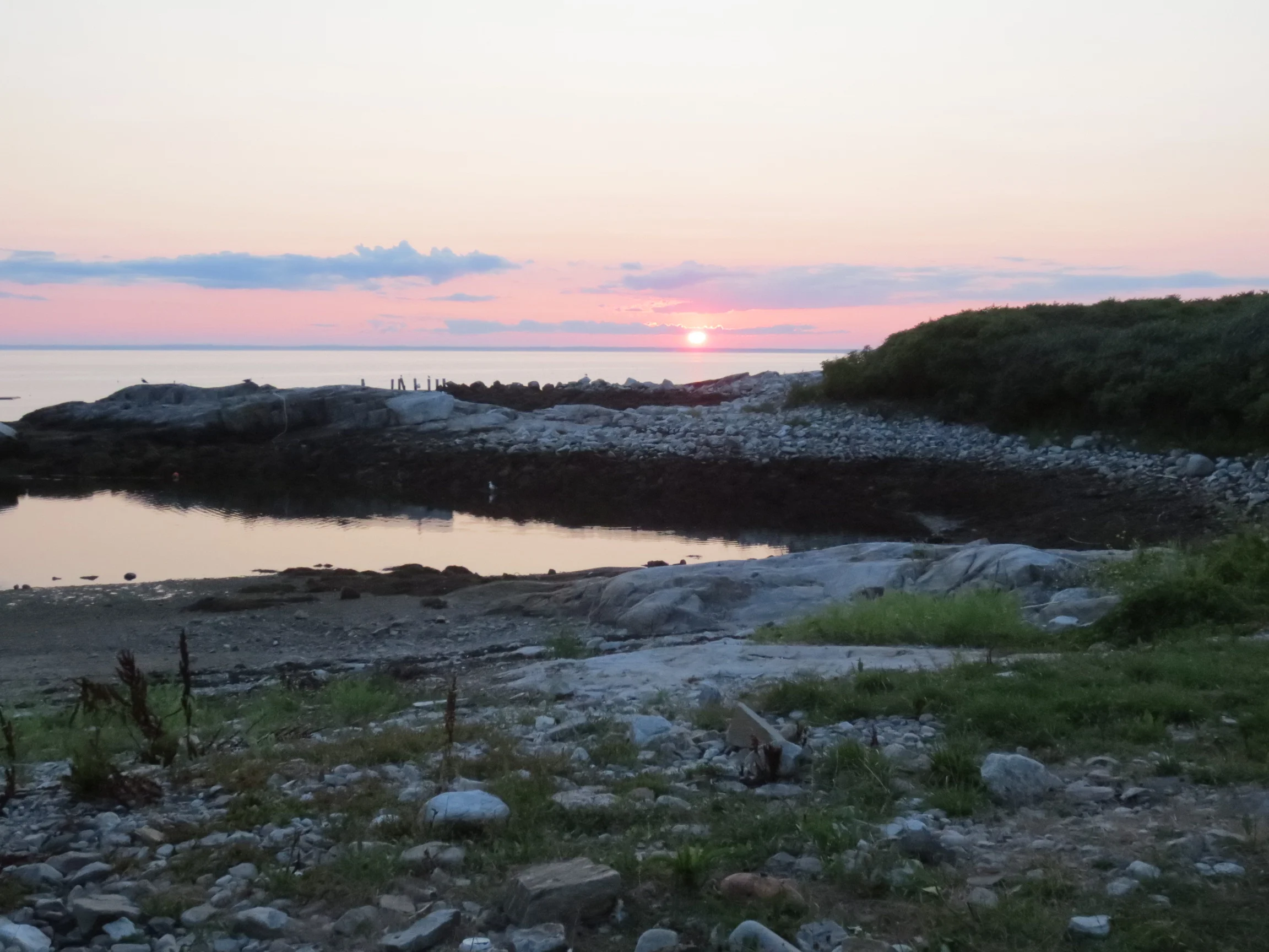
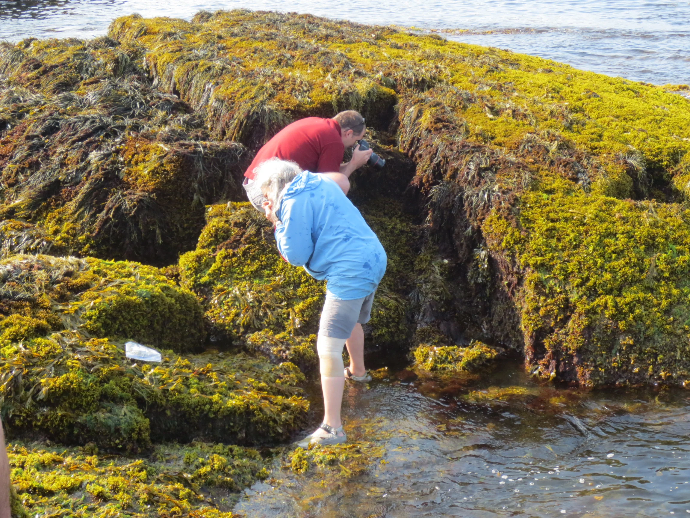
This summer has been not only busy on-island with student programs, but also a busy field season collecting data for our collaborative scallop research project. In July 2014, we were awarded a grant administered by Maine Sea Grant with funding from the Maine Community Foundation and the Broad Reach Fund. In early August, we started conducting our second year of dive surveys on Muscle Ridge and Ocean Point.  So far we have completed a total of 16 dive surveys on the Ocean Point scallop closure (you can read more about how this project has been set up here), and surrounding area to assess scallop abundance and to collect samples. These surveys have been conducted with the help of scientists from the Maine Department of Marine Resources and from our HIF science advisor, Dr. Rick Wahle's Lab based at the University of Maine's School of Marine Sciences. I've also been able to work alongside Susie Arnold, the Island Institute's marine scientist, to dive on Muscle Ridge. We've completed 8 sites so far and are hoping to get a few more days of diving in before fall officially arrives!

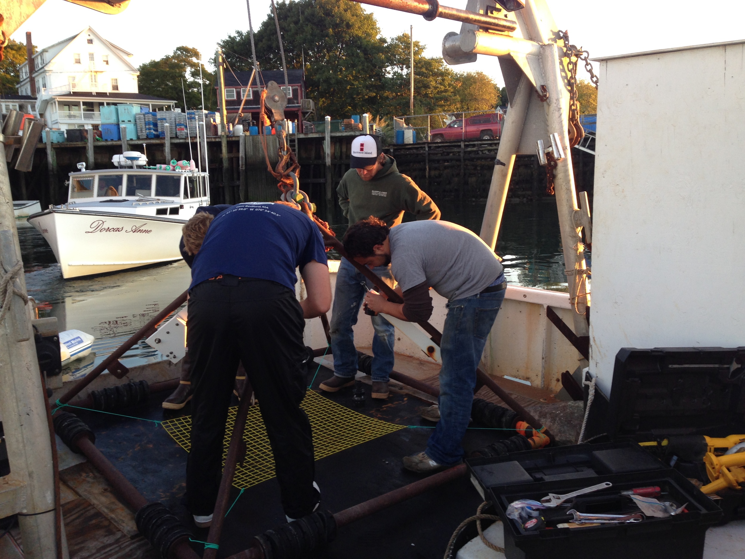
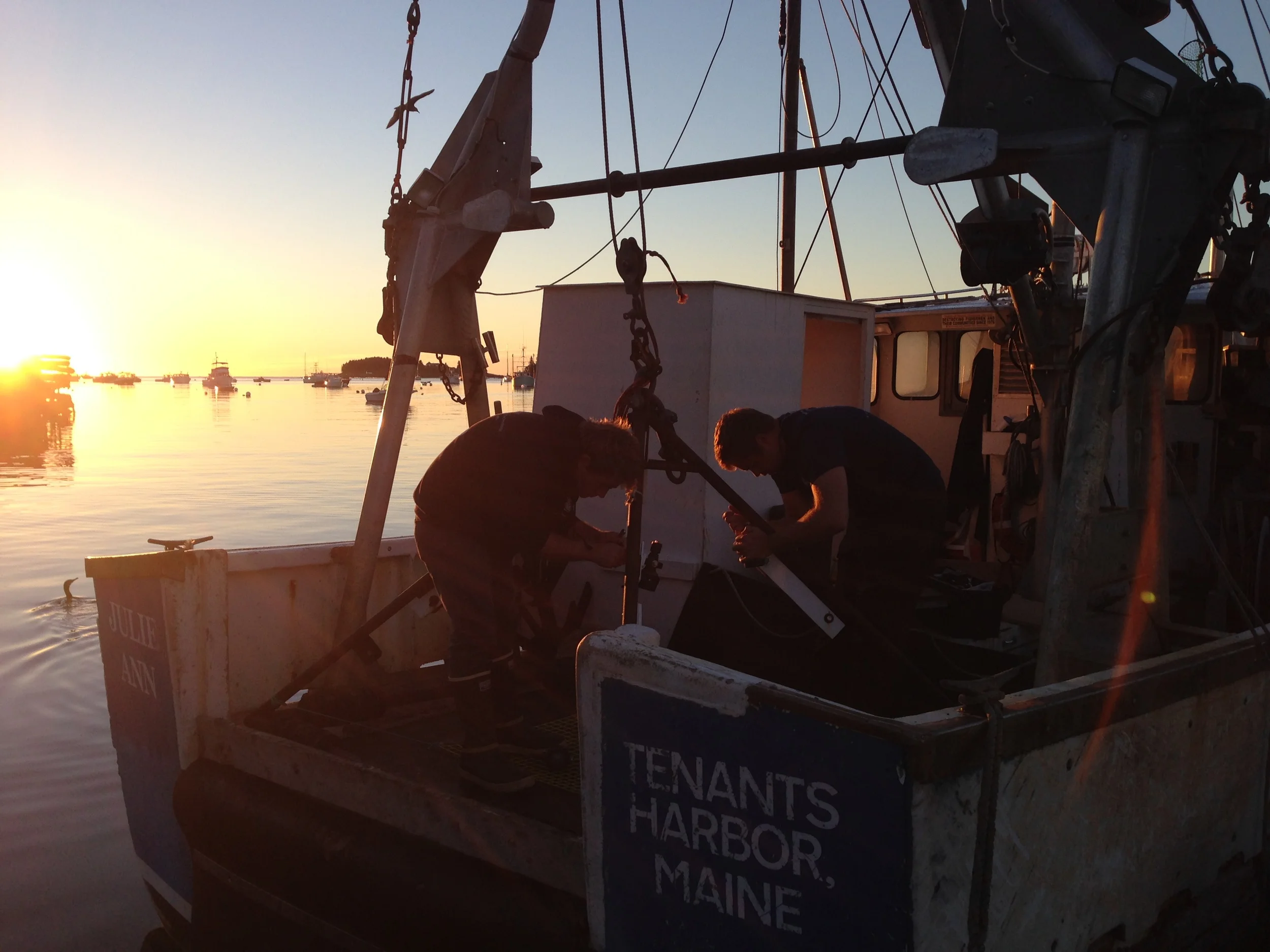
On September 11, 2014, a crew from Dr. Kevin Stokesbury's lab based at the University of Massachusetts at Dartmouth arrived in Maine and set up their drop camera rig on Tad Miller's dragger, F/V Julie Ann in Tenants Harbor. We then did three days of drop camera surveys on Muscle Ridge. To identify the sampling stations, we laid a 200 m x 200 m grid over the survey area and marked the center of each cell. We would then steam to the latitudinal and longitudinal coordinates of that center point and drop the camera to the bottom to take footage of the life below.  Fortunately, we did not have any major technical difficulties and were able to increase the number of sites we sampled this year as compared to October 2013 where we lost a cable which limited our ability to sample deeper sites. 

This weekend (September 19 - 21, 2014), I will work with one of our industry partners to set the spat bags out which will then be collected and processed next June. I hope we are able to wrap up the field work by the end of October then on to analysis and preparing for the 2015 field season!

Subscribe in a reader

Visit to Shoals Marine Lab, Appledore Island

At the end of July 2014, Sam Hallowell, the Director of the Hurricane Island Center for Science and Leadership and I caught a boat out of Portsmouth, NH to visit the Shoals Marine Lab on Appledore Island off the coast of southern Maine. The University of New Hampshire and Cornell University operate the facility and host a series of two-week long summer courses for undergraduate students taught by visiting faculty from around the country. In addition to the courses, they also support undergraduate interns and visiting researchers. Many of the faculty we spoke with had an early career experience at Shoals and had opted to return as a professor or in some other capacity. This returning alumni base is what we're striving to achieve on Hurricane as well and I believe this approach will definitely help augment the existing educational community currently on the island. 

Sam was particularly interested in the infrastructure aspect of the facilities and was able to walk around the campus with one of their three facilities manager. They have a large solar array that powers their main building, the dorms, and classrooms as well as  a number of flowing seawater tables for teaching and short-term experiments in the lab. A dive program is up and running complete with a dive locker and an AAUS scientific diving course. 

I spent time with four interns and two instructors who were collecting data for the long-term intertidal monitoring on Shoals. Dr. Kathy Ann Miller allowed me to tag along with the group on their first day in the field. Our summer intern, Collin, worked to implement a similar protocol on Hurricane so we will eventually be able to compare changes in intertidal community composition over time between Appledore Island and Hurricane Island. We are currently working with Kathy Ann to continue the relationship between Shoals and Hurricane and we hope to host her summer interns next summer after their time on Shoals... stay tuned!

Subscribe in a reader

Forest Health Assessment Results

Post by Chloe Tremper, Science and Education Intern 2014

Throughout this past summer, I have gotten to know the forests of Hurricane very well, particularly the spruce-fir stand on the northern half of the island along Slocum’s Trail.  Red spruce (Picea rubens) is by far the most dominant species on the island but is generally only found in the interior the spruce-fir stand on the island.  White spruce (Picea glauca) lines the edges of the stand along trails and the coast but is completely absent from the interior of the stand.  This reflects the white spruces near inability to survive in suppressed conditions and reproduce in closed canopy conditions.  Balsam fir (Abies balsamea) is the last species of tree I found within my study area and the least abundant.  However, when it was found it was generally in plots near the coast and it was always found in concentrated groups.

0
0
1
8
50
Hurricane Island Foundation
1
1
57
14.0


Normal
0


false
false
false

EN-US
JA
X-NONE


 <w:LatentStyles DefLockedState="false" DefUnhideWhenUsed="true"
DefSemiHidden="true" DefQ…

Coring a red spruce to count growth rings to estimate age

Very few of the trees within my sampling area had reached their full growth potential, despite some of them being well over one hundred years old.  This can mostly be attributed to having grown in a less than favorable environment with high competition for very limited resources among individual trees.  Hurricane’s climate (particularly its regular inundation of ocean fog) and shallow, acidic soils are two factors making the island a harsh environment for the trees to survive in. 

Overall, Hurricane’s spruce-fir stand is doing pretty well.  Fire is the biggest risk currently facing Hurricane’s forest due to the massive amount of dead woody debris on the forest floor and the fact that spruce needles are extremely flammable.  The possibility of windthrow (when trees are uprooted by wind) is also fairly high due to the shallow soils and the naturally shallow rooting systems of spruce and fir trees. There is also the potential for an infestation of witches’ broom (a dense mass of shoots growing from a single point off a tree caused by variety of things – generally fungi or a virus) as it is already present on some of the spruce trees along the eastern coast of the island. 

Subscribe in a reader

Visit to Great Duck

View of the keeper's house from the lighthouse.

View of the keeper's house from the lighthouse.

We are in the formative stages of building a field research station on Hurricane Island – an exciting, but also challenging time in figuring out the right scale for a station on an island in Penobscot Bay. During this process, I have found discussions with scientists who run field stations invaluable in guiding my thinking on the development of our station. On July 12, 2014, I had the opportunity to visit College of the Atlantic’s (COA) Alice Eno Field Research Station on Great Duck Island. COA, the State of Maine, the Nature Conservancy, and a private residence share the 220-acre island. We took COA’s research vessel, a 46’ West Mac, from COA’s campus in Bar Harbor out to the island. The facilities are modest and completely off the grid which is similar to Hurricane. I gained important insight into the appropriate scale of necessary infrastructure to support researchers for a period of time on an island.

Each summer, Dr. John Anderson, a COA faculty member, oversees a team of six to seven students that conducts research on Great Duck, often focusing on the breeding populations of Leach’s Storm Petrels and resident Herring and Black-backed Gulls that nest on the island each year. Through cooperative agreements, COA students can access the majority of the island to conduct research projects.

Great Duck and Hurricane have some interesting similarities and differences. Both were inhabited and used by humans in the nineteenth and early twentieth centuries; Hurricane supported a thriving quarry town while Great Duck had a lighthouse keeper’s family and a flock of sheep (for more on Great Duck's history, click here). Hurricane was subjected to a second period of human pressure from the 1960s to the mid-2000s. Once these inhabitants left their respective islands, vegetation was released from human pressures and regenerated. Spruce-fir forests now dominate both islands; however, Great Duck has a stand of similarly aged trees as saplings rarely survive due to grazing of introduced hare while on Hurricane, we have a number of young spruce trees and will potentially experience overcrowding issues. We do have a number of deer on Hurricane, but have not yet quantified their grazing effect on our vegetation. 

Subscribe in a reader

Intertidal Surveys of Hurricane Island

Post by Collin Li, Research and Education Intern, University of Miami

Over the course of my studies I have found that scientists are obsessed with recording change over time. With the world constantly changing around us, it only makes sense to document changes, ask questions to help identify the cause behind our observations, and provide explanations for what we see. Here at Hurricane Island, we are no exception, although we are just beginning to establish our monitoring sites in order to observe change. It is my goal this summer to create a protocol so that the intertidal systems along the shores of Hurricane Island can be sampled and observed over time. I have selected two sites: one at Valley Cove and one at Two Bush Island (which connects to Hurricane Island at low tide). Each site was selected for its gentle slope and distance of the barnacle line to the water line. What makes these two locations differ is that Two Bush is an exposed coastal line whereas Valley Cove is protected. The differences between the zonation structure and organisms found at these two sites will be interesting to quantify. Another main difference between these sites is that Two Bush Island is often used for hands-on intertidal work with students whereas Valley Cove is relatively untouched. We are curious to see if there is a noticeable difference or impact on the intertidal organisms that see higher human traffic. I have established three permanent transects at each site, so that the project can be revisited each year. The high point of each transect was determined by finding the point on the intertidal 13.5 feet above Mean Low Water. Afterwards, each foot decrement was marked off dividing the transect into 13 levels. At each level, a 20cm x 20cm quadrat is sampled at a point most representative of the level.  We plan to monitor these sites over the years, and think about the changes we observe within the context of global sea level rise, ocean warming, and ocean acidification. Best of all, students in our Marine Ecology ISLE programs will help us monitor these sites and contribute to the research that happens on Hurricane Island. 

Subscribe in a reader