Science for Everyone

Internships

Forest Health Assessment Results

Post by Chloe Tremper, Science and Education Intern 2014

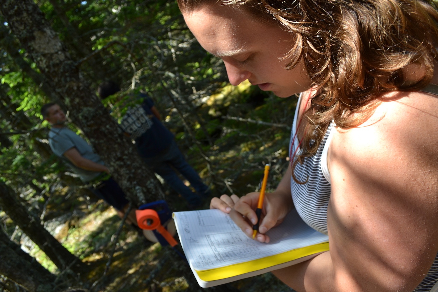
Throughout this past summer, I have gotten to know the forests of Hurricane very well, particularly the spruce-fir stand on the northern half of the island along Slocum’s Trail.  Red spruce (Picea rubens) is by far the most dominant species on the island but is generally only found in the interior the spruce-fir stand on the island.  White spruce (Picea glauca) lines the edges of the stand along trails and the coast but is completely absent from the interior of the stand.  This reflects the white spruces near inability to survive in suppressed conditions and reproduce in closed canopy conditions.  Balsam fir (Abies balsamea) is the last species of tree I found within my study area and the least abundant.  However, when it was found it was generally in plots near the coast and it was always found in concentrated groups.

0
0
1
8
50
Hurricane Island Foundation
1
1
57
14.0


Normal
0


false
false
false

EN-US
JA
X-NONE


 <w:LatentStyles DefLockedState="false" DefUnhideWhenUsed="true"
DefSemiHidden="true" DefQ…

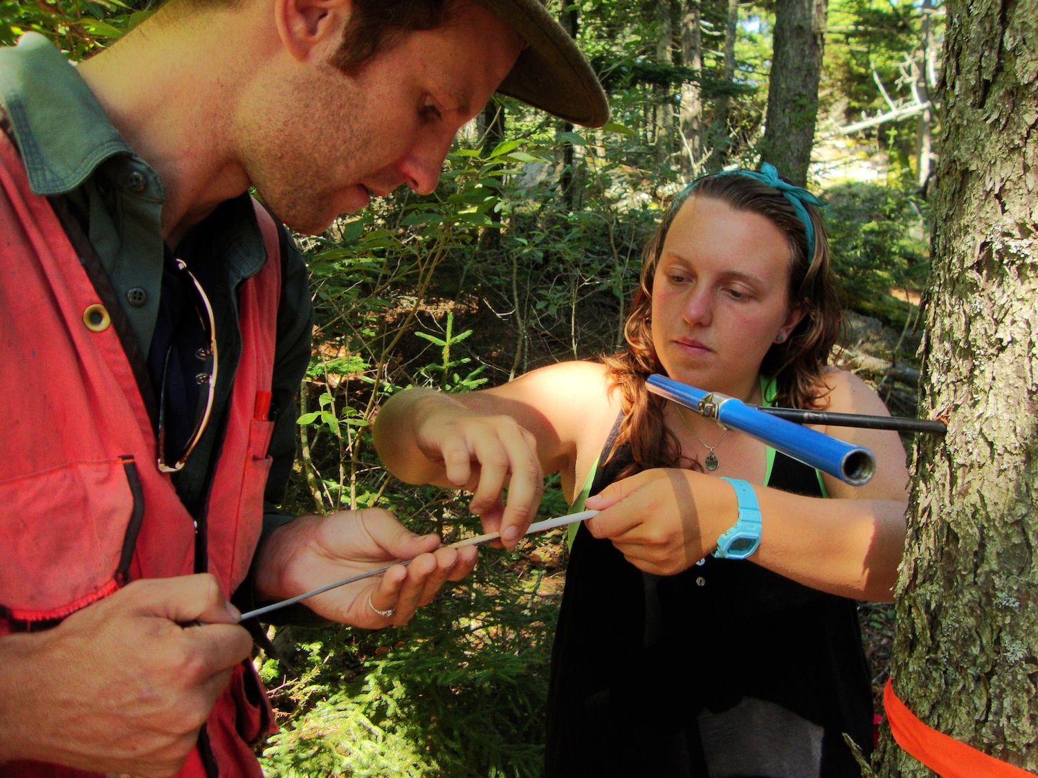
Coring a red spruce to count growth rings to estimate age

Very few of the trees within my sampling area had reached their full growth potential, despite some of them being well over one hundred years old.  This can mostly be attributed to having grown in a less than favorable environment with high competition for very limited resources among individual trees.  Hurricane’s climate (particularly its regular inundation of ocean fog) and shallow, acidic soils are two factors making the island a harsh environment for the trees to survive in. 

Overall, Hurricane’s spruce-fir stand is doing pretty well.  Fire is the biggest risk currently facing Hurricane’s forest due to the massive amount of dead woody debris on the forest floor and the fact that spruce needles are extremely flammable.  The possibility of windthrow (when trees are uprooted by wind) is also fairly high due to the shallow soils and the naturally shallow rooting systems of spruce and fir trees. There is also the potential for an infestation of witches’ broom (a dense mass of shoots growing from a single point off a tree caused by variety of things – generally fungi or a virus) as it is already present on some of the spruce trees along the eastern coast of the island. 

Subscribe in a reader

Intertidal Surveys of Hurricane Island

Post by Collin Li, Research and Education Intern, University of Miami

Over the course of my studies I have found that scientists are obsessed with recording change over time. With the world constantly changing around us, it only makes sense to document changes, ask questions to help identify the cause behind our observations, and provide explanations for what we see. Here at Hurricane Island, we are no exception, although we are just beginning to establish our monitoring sites in order to observe change. It is my goal this summer to create a protocol so that the intertidal systems along the shores of Hurricane Island can be sampled and observed over time. I have selected two sites: one at Valley Cove and one at Two Bush Island (which connects to Hurricane Island at low tide). Each site was selected for its gentle slope and distance of the barnacle line to the water line. What makes these two locations differ is that Two Bush is an exposed coastal line whereas Valley Cove is protected. The differences between the zonation structure and organisms found at these two sites will be interesting to quantify. Another main difference between these sites is that Two Bush Island is often used for hands-on intertidal work with students whereas Valley Cove is relatively untouched. We are curious to see if there is a noticeable difference or impact on the intertidal organisms that see higher human traffic. I have established three permanent transects at each site, so that the project can be revisited each year. The high point of each transect was determined by finding the point on the intertidal 13.5 feet above Mean Low Water. Afterwards, each foot decrement was marked off dividing the transect into 13 levels. At each level, a 20cm x 20cm quadrat is sampled at a point most representative of the level.  We plan to monitor these sites over the years, and think about the changes we observe within the context of global sea level rise, ocean warming, and ocean acidification. Best of all, students in our Marine Ecology ISLE programs will help us monitor these sites and contribute to the research that happens on Hurricane Island. 

Subscribe in a reader

Forest Health Assessment of Hurricane Island

Post by Chloe Tremper, Science and Research Intern, Project Update 

For my summer research project, I am completing a forest health assessment of the spruce-fir stand on the northern half of Hurricane Island.  Forest health and how to assess it is hugely subjective depending on the forest type you’re working with and what your definition of “healthy” is.  For this particular assessment I decided to focus on damage and disease within the forest, regeneration, blow down risk, and fire risk.  Since little is known about Hurricane’s forests, my project aims to determine any major risks currently facing the spruce-fir stand on the island as well as recommend any needed management and improved methods of monitoring the overall forest health into the future.

In order to complete this assessment in a few short weeks by myself, I decided to collect data at 12 plots within the spruce-fir stand.  Using Slocum’s Trail as the base of my 600m transect, I used a random number generator to determine 12 random distances between 0 and 600m.  After each of these distances were measured out and flagged, the real fun began! At each distance in from the start of the transect, I start by flipping a coin to determine if the plot will be on the left or right side of the trail: heads means right and tails means left.  After that, I roll a di to determine the distance into the stand I go from Slocum’s (1=5m, 2=25m, 3=50m, 4=75m, 5=100m, 6=150m).

Chloe enters data with ISLE botany students recording DBH for white and red spruce trees in a plot

Chloe enters data with ISLE botany students recording DBH for white and red spruce trees in a plot

Once at each plot center, I set up a 5x5m square plot.  Within that plot I record the species, DBH (diameter at breast height), and signs of damage/disease for each tree.  I am also recording the number of 1-hour, 10-hour, 100-hour, and 1000-hour fuels. 1-hr fuels are debris less than 1/4in diameter (twigs, needles, dead grass), 10-hr are woody debris 1/4 – 1in in diameter, 100-hr are woody debris 1 - 3in in diameter, and 1,000-hr are woody debris greater than 3in in diameter. These numbers are important for estimating the risk of a fire within the stand as well as how much potential damage a fire would cause.  I also tally the number of spruce saplings, fir saplings, Vaccinium spp., and other woody saplings or shrubs in order to get an idea of what would likely take over a plot if the large trees were to die back.  Once all these data are recorded, I measure the soil depth in the northwest corner of each plot.  Knowing the soil depth is helpful in considering the risk of blow-downs. 

I am taking notes about each plot including information about the openness of the canopy, exposed bedrock, fallen trees, herbaceous cover, etc.  So far, I have 8 of the 12 plots completed.  I finished 3 of these plots with help from our SLE Botany students! Of the plots I have completed, I’ve noticed a lot of diversity among them, however the one thing I have seen throughout is a lot of dead woody debris which puts the island at a huge risk if there were to ever be a fire on the island.  Remember, only you can prevent forest fires! 


Subscribe in a reader

First Impressions of Hurricane Island: Chloe

Post by Chloe Tremper (Summer 2014 Science and Education Intern)

Lots of familiar, lots of new.  My first impression started at the Hurricane Island Foundation office in Rockland.  I opened the door to the office and was immediately greeted by two very happy dogs followed by Cait, and I couldn’t have had a better welcome.  Once we pulled up to Hurricane Island itself I was immediately struck with how beautiful the island is. I couldn’t think of a better place to be spending my summer. Every staff member I met throughout the day was really nice and it was pretty apparent they are a tight-knit group of people who love what they do even with the challenges that come along with jobs like theirs.

Chloe on one of the Hurricane Island trails

Chloe on one of the Hurricane Island trails

After getting a chance to walk around the island a bit, everything seemed very familiar.  The forested areas on the island made me feel like I was back in the spruce-fir forests that I’m used to seeing on the mountaintops of Vermont. Dark-eyed juncos, golden-crowned kinglets, Swainson’s thrushes, all birds I’m used to hearing in the dead silence of a mountaintop, I’m now hearing with the crash of ocean waves in the background. On top of that, here I am on an island with an elevation of less than 200ft and I’m seeing mountain ash, red spruce, mountain paper birch, and balsam fir--it’s pretty neat!

Overall, my first impression of Hurricane Island was a great one.  I’m looking forward to getting to know the island better and being able to navigate myself around the trails. I am also really excited to get started with the ISLE classes and my research project to assess the health of Hurricane Island’s forest stands (more on that later!). 

Subscribe in a reader

First Impressions of Hurricane Island: Collin

Post by Collin Li (Summer 2014 Science and Education Intern)

The voyage to Hurricane Island was swift. The cool breeze and frigid waters heavily contrasted with what I was used to, but I was too excited to lay eyes upon my home for the next two months to care. After unloading my gear, HIF staff gave us a tour of the infrastructure and I immediately noticed how environmentally conscience the Foundation is. Solar panels lined many roofs, skylights were installed in the cabins, and the composting "throne" toilets, and outhouses with Dutch doors were a plus.

Our hikes later that evening allowed me to begin to explore the inner parts of the island and learn about the local flora and fauna. The task seemed daunting at first, but it is great to be immersed in this learning environment, and with repetition I have been able to pick out the more vocal birds and trailside plants.

As I hiked the trails, I felt like I was walking through a scene of the Hobbit. The songs of white throated sparrows and Swainson's thrushes filled the temperate evening air. Mosses found their homes on rocks and the trunks of the towering white spruces. And the stars began to glisten as the sun set over the mainland. The Island is a place teeming with life and inhabited by the Foundation. Through their work, science education and sustainable living is fostered in the hopes of creating leaders within the field of science for the future. Looking forward, it is exciting to take part in the HIF mission this summer and see what we can accomplish!

Subscribe in a reader