Science for Everyone

science modeling

Building Passive Drifters to Monitor Ocean Currents

This year the Eastern Maine Skippers Program students had a chance to build passive drifters with the help of Jim Manning (NOAA) and Cassie Stymiest (NERACOOS). Deploying passive drifters enables researchers to get a better sense of broad current patterns in different parts of the ocean, which is relevant to plankton researchers, teams reacting to oil spills, search and rescue teams, and other oceanographers. 

Passive Drifter track lines from drifters that are currently pinging out GPS locations

Passive Drifter track lines from drifters that are currently pinging out GPS locations

There are several examples where knowledge of currents from passive drifter data enabled teams to react and mitigate accidents. One significant incident occurred in March of 2011, when the Hooksett Wastewater Treatment Plant (Hooksett, NH) accidentally released several million small gridded plastic disks into the Merrimack River. These disks subsequently washed up along the coast of New Hampshire, Massachusetts, and Southern Maine. When the incident occurred, New Hampshire was able to ask for a model from the data collected by previous passive drifters to predict where the disks would end up. 

Another accidental passive drifter story happened in May of 1990 when 61,000 Nike shoes were released from a shipping container in the North Pacific. This was the largest (albeit accidental) release of drifters, and oceanographers were actually able to validate some of the models by looking at the data from where shoes were washing up. 

One of the reasons it is helpful to keep building, deploying, and tracking drifters from different locations is to add more data to oceanographic models. Although individual drifter paths at first glance seem to have a lot of variability, by averaging their collective movements scientists can gain a more accurate understanding of oceanographic patterns. Our ocean circulation is not fixed, and especially in the context of a changing climate it is important to see how the oceans are responding to warming waters and different wind patterns. 

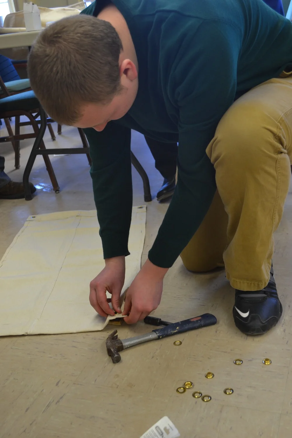
Building passive drifters is simple and fun! The following are the main assembly steps that the skippers worked on during this workshop:

  1. Cutting and gluing the canvas sails
  2. Attaching grommets to the sails
  3. Assembling the central metal mast
  4. Assembling the mount to hold the GPS transmitter

The final step will be for students to attach the GPS transmitters to their drifters and deploying them so we can track their movements in Penobscot Bay!

We are also looking forward to helping out the drifter dataset by deploying a passive drifter during our Marine Biology program on Hurricane Island! Stay tuned! Want to set up and deploy your own passive drifter? Check out StudentDrifters.org

Subscribe in a reader

Climate Change Discussed at the 40th Fishermen's Forum

One of the annual highlights in March in Maine is the Fishermen's Forum, a 3-day event that includes seminars, a trade show, and different evening events such as a seafood dinner and auction. This March marked the event's 40th year, which is a testament to the importance of fisheries to Maine's economy and community identity. This is the 3rd year Hurricane Island has had a booth and attended seminars at the event, and we always look forward to meeting new people and learning more about the hot-button issues in Maine fisheries. On Saturday, March 7, 2015 I attended a session co-hosted by the Island Institute and the Gulf of Maine Research Institute (GMRI) entitled “Forecasts, Tools, and Research to support Fisheries in Adapting to a Rapidly Changing Gulf of Maine." Speakers included staff from the Island Institute, GMRI, NERACOOS (Northeast Regional Association of Coastal and Ocean Observing System), and graduate students and professors from the University of Maine. The first half of the session focused on the changes that have been happening over the last few years in terms of warming waters and the resulting effects on oceanographic and biological processes, such as the earlier timing of the lobster shed following the Gulf of Maine "heat wave" in 2012 and the timing and strength of the spring and fall plankton blooms. Andy Pershing, GMRI Chief Scientific Officer, concluded that we can expect to see colder winters and warmer summers and falls which will continue to contribute to the overall warming trend in water temperatures in the Gulf of Maine. Dr. Pershing's model predicts that the result of warming temperatures will likely lead to lower cod recruitment and greater lobster landings. 

During the second half of the three-hour session, presenters highlighted tools that exist or are being developed to help individuals track change at various spatial and temporal scales. One notable tool is GMRI's climate dashboard and model to forecast the start of the summer lobster shed based on water temperature data. Another model presented during the session was a lobster landings forecasting model developed by one of our science advisors, Noah Oppenheim, as part of his graduate work. Noah's model predicts regional landings based on data from the New England Lobster Settlement Index and other sources. Finally, NERACOOS offers a wealth of data that is easily accessible through the real time data portal where you can compare daily data on temperature to the average over a larger timeframe. 

All in all, the session revealed the number of organizations and individuals working to understand climate change in the Gulf of Maine and how we can support adaptation in our fisheries. I plan to incorporate information I learned during this session into my panel presentation, “Climate Change in Maine” at the first Maine Science Festival in Bangor on March 21, 2015.

Subscribe in a reader